
We use cookies to enhance your browsing experience, serve personalized content, and analyze our traffic. By clicking "Accept All" you accept this and consent that we share this information with third parties and that your data may be processed in the USA. For more information, please read our .
You can adjust your preferences at any time. If you deny, we will use only the essential cookies and unfortunately, you will not receive any personalized content.

A massive storm system is tearing across the United States on Monday, bringing a rare combination of tornado warnings, blizzard conditions, and widespread travel chaos to tens of millions of people stretching from the Gulf Coast to the Great Lakes. The southern edge of the storm is producing dangerous thunderstorms and tornadoes while the northern side is burying parts of the Midwest in feet of snow. If you have travel plans anywhere in the eastern half of the country today, here's what you need to know.
The most urgent threat Monday is severe weather across the Southeast and Mid-Atlantic. Nearly 13 million people are under a Level 4 out of 5 severe weather risk, one of the highest categories the Storm Prediction Center issues. Another 25 million people from Florida to New York are under moderate risk.
The storm kicked up Sunday with wind speeds approaching 80 mph in some locations, and a tornado was already confirmed near Humphrey, Arkansas. Parts of east Texas were hit with hail the size of tennis balls. The line of storms has been racing east ever since, and meteorologists warn Monday's conditions could be worse before they get better.
The areas of greatest concern are South Carolina, North Carolina, Virginia, and Maryland, with the threat extending north toward Pennsylvania and New Jersey. Storms could produce:
Tornadoes, some potentially strong and long-lived
Damaging wind gusts exceeding 75 mph
Large hail
Heavy rain and lightning
While the South is dealing with storms, the northern half of the system is a different kind of dangerous. Nearly 11 million people are under blizzard warnings Monday, with another 20 million under winter weather alerts stretching from the Midwest into New England.
Snow totals have already hit one to two feet across parts of Minnesota, Wisconsin, and northern Michigan, and some areas are on track for historically high totals. Rochester, Minnesota could see one of its snowiest storms on record. Michigan's Upper Peninsula is forecast to receive more than three feet of snow before the system moves through. Powerful winds are turning that snow into near-total whiteout conditions, making roads not just difficult but genuinely impassable in some areas.
The storm has already caused significant disruption across the country, and the numbers are still climbing. As of Monday morning:
Nearly 500,000 customers were without power across seven states
Over 1,500 flights were canceled nationwide
More than 800 flights were delayed
Interstate 80 in Iowa was closed in both directions
The Mackinac Bridge in Michigan was shut down entirely
Major airports across the Midwest and Great Lakes have been hit hard. Minneapolis-Saint Paul saw more than 600 cancellations alone, and Chicago's O'Hare and Midway reported over 850 combined. If you're connecting through any Midwest hub today, check your flight status before you leave for the airport.
School districts across Washington D.C., Maryland, Virginia, North Carolina, South Carolina, and Georgia have announced closures, delays, or early dismissals. Maryland Governor Wes Moore declared a state of preparedness Sunday night, and Baltimore County activated its emergency operations center. Atlanta and Charlotte area districts shifted to virtual learning as the storms approached.
Most major storms hit one region hard. This one is hitting almost everywhere at once, and the combination of severe thunderstorm risk in the South and historic blizzard conditions in the Midwest is genuinely unusual for mid-March. Meteorologists expect the worst conditions to ease by Monday evening as the system pushes toward the East Coast, but travel disruptions and power outages are likely to linger well into Tuesday.
If you have flights, road trips, or any travel planned across the eastern U.S. today, build in extra time, check conditions before you leave, and have a backup plan. This storm is moving fast and the situation is changing by the hour.
A major multi-day storm system is affecting tens of millions of people across the eastern United States with a combination of tornado warnings, severe thunderstorms, blizzard conditions, and heavy snow. Nearly 13 million people are under a Level 4 out of 5 severe weather risk in the mid-Atlantic, while 11 million are under blizzard warnings in the Midwest and Great Lakes.
The most severe impacts are being felt across South Carolina, North Carolina, Virginia, Maryland, Minnesota, Wisconsin, and Michigan. Tornado and severe thunderstorm risks extend from the Florida Panhandle to New Jersey, while blizzard conditions stretch from Iowa to Michigan's Upper Peninsula.
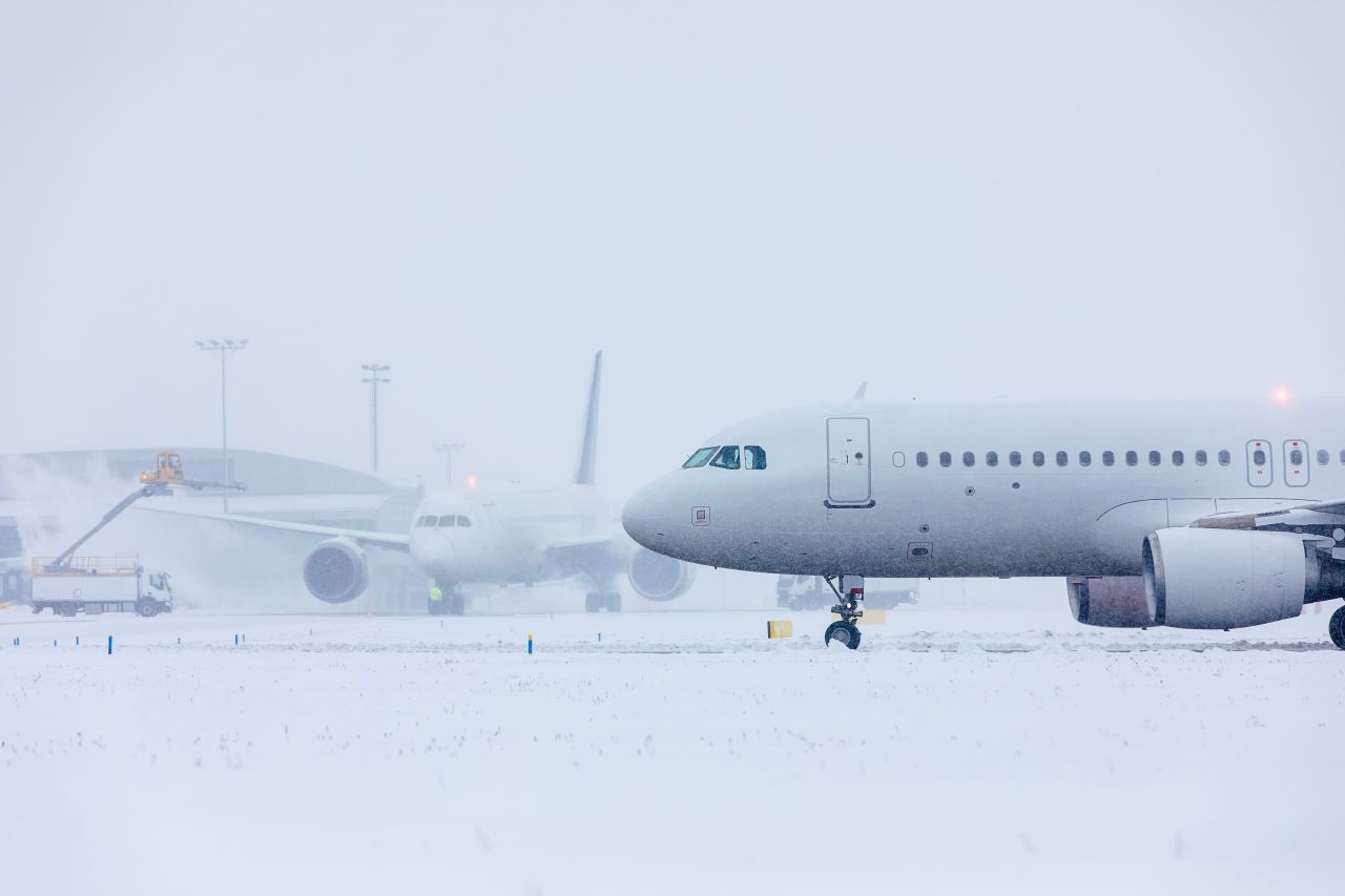
As of Monday morning, more than 1,500 flights within, into, or out of the U.S. have been canceled and over 800 delayed. Minneapolis-Saint Paul Airport saw more than 600 cancellations, while Chicago's O'Hare and Midway airports reported over 850 combined.
In many areas, no. Blizzard conditions have made roads impassable across parts of Iowa, Wisconsin, and Michigan. Interstate 80 in Iowa was closed in both directions, and the Mackinac Bridge in Michigan was shut down entirely. Authorities in multiple states are urging residents to stay off the roads.
Meteorologists expect the worst conditions to ease by late Monday afternoon and evening as the system moves toward the East Coast. However, travel disruptions and power outages are likely to continue into Tuesday in many areas.
Yes. School districts across Washington D.C., Maryland, Virginia, North Carolina, South Carolina, Georgia, Minnesota, Wisconsin, Alabama, and Florida have announced closures, delays, or early dismissals.
As of Monday morning, nearly 500,000 customers were without power across seven states, including over 100,000 in Michigan and more than 50,000 each in Ohio and Georgia.
Check your flight status directly with your airline before leaving for the airport. Avoid driving in blizzard-warned areas if at all possible. Monitor the National Weather Service and local emergency management channels for real-time updates, and have a flexible backup plan if your travel is affected.