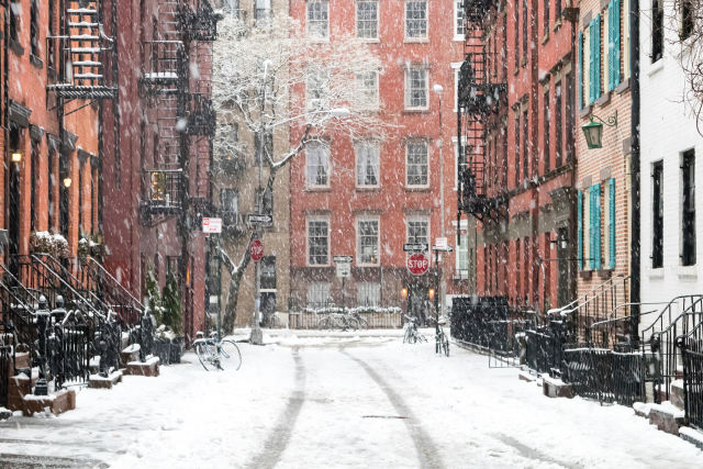
We use cookies to enhance your browsing experience, serve personalized content, and analyze our traffic. By clicking "Accept All" you accept this and consent that we share this information with third parties and that your data may be processed in the USA. For more information, please read our .
You can adjust your preferences at any time. If you deny, we will use only the essential cookies and unfortunately, you will not receive any personalized content.

A rapidly intensifying bomb cyclone is bringing heavy snow, powerful winds, and widespread travel disruptions across the I-95 corridor. Snowfall rates in New York City have already reached 2 inches per hour, with 5 to 7 inches recorded before midnight, prompting a state of emergency and a citywide travel ban as conditions worsen overnight.
For major cities including New York City, Philadelphia, and Boston, this storm could become one of the most significant snow events in nearly a decade. Public transit systems are suspending service, thousands of flights have been canceled, and additional travel bans are now in effect across parts of the region. For residents and travelers alike, the next 24 hours will determine just how disruptive this storm ultimately becomes.
Meteorologists say the system is undergoing rapid intensification, often referred to as bombogenesis. As the storm strengthens offshore, it is pulling moisture from the Atlantic and colliding with colder air over land, creating ideal conditions for heavy snowfall and blizzard-level winds.
Blizzard warnings now stretch across much of the Northeast. In several states, governors have declared states of emergency in anticipation of:
Snow totals between 18 and 24 inches in major metro areas
Localized accumulations exceeding 2 feet along coastal zones
Sustained winds over 35 mph with gusts reaching 60 to 70 mph
Visibility below a quarter mile during peak snowfall
Coastal flooding during high tide cycles
If forecasts verify, snowfall totals in Central Park could place this event among the top ten snowstorms in New York City's recorded history.
Unlike the dry, powdery snow seen during colder January systems, this storm is arriving with temperatures hovering near freezing. That means the snow will be wetter and significantly heavier.
Heavy snow increases the risk of:
Downed trees and power lines
Prolonged power outages
Roof stress from accumulated weight
More physically demanding shoveling conditions
As of shortly after midnight, more than 150,000 homes and businesses across the Northeast and Mid-Atlantic were without power, and that number is expected to fluctuate as heavy snow and strong winds continue. Coastal communities from New Jersey through Massachusetts are also facing the added concern of moderate to locally significant coastal flooding as strong onshore winds push water toward shore.
Travel disruptions are widespread and may continue even after snowfall ends.
Airports across the Northeast have reported thousands of cancellations, particularly at major hubs serving New York City, Philadelphia, and Boston. Airlines are offering flexible rebooking options, but recovery delays could extend several days as aircraft and crews are repositioned.
New York City’s travel ban prohibits all non-essential vehicles from operating on city streets, highways, and bridges until at least noon Monday. Vehicles on the road without authorization may face fines or towing. Ride-share services and delivery operations may be paused in affected areas. Rail service along portions of the I-95 corridor is reduced or suspended in some regions. Even where service continues, schedule changes are likely.
If you are scheduled to travel through the Northeast:
Check your airline, rail, or bus provider before leaving home
Monitor official city and state travel advisories
Do not attempt to drive during a declared travel ban
Expect delays that may extend beyond the storm itself
Consider postponing nonessential trips
A delayed flight is inconvenient. Driving during an active travel ban is both unsafe and legally problematic. Officials are urging residents and visitors to remain indoors until restrictions are lifted and road conditions stabilize.
New York City has already recorded between 5 and 7 inches of snow, with heavy bands continuing overnight. If totals in Central Park approach the 18 to 20 inch range, this storm would rank among the city’s most significant snow events in recorded history, though still below the 27.5 inches recorded in January 2016.
City agencies have activated sanitation crews, emergency responders, and warming centers. Public schools have canceled classes, and the state of emergency remains in effect as crews work to keep major routes passable.
This storm is being taken seriously enough that New York City is already preparing by recruiting emergency snow shovelers ahead of time. In the aftermath of heavy snowfalls, the Department of Sanitation brings on temporary workers to clear bus stops, crosswalks, fire hydrants, and other public areas that need immediate attention.
Current pay starts at $19.14 per hour, increasing to $28.71 per hour after 40 hours worked in a week. Applicants must:
Be at least 18 years old
Be eligible to work in the United States
Be able to perform heavy physical labor
Snowfall should taper late Monday, though winds may linger into the evening. After that, the region shifts from bracing for impact to steady recovery. Plows will work through the night, airports will begin the careful process of restoring schedules, and utility crews will address outages where heavy snow and wind caused damage.
For travelers, the clearest takeaway is patience. Even once skies clear, flight networks and rail corridors need time to rebalance. A storm of this scale does not simply switch off. Recovery happens in stages, and flexibility over the next few days will ease the experience considerably.
For residents, the rhythm will feel familiar. Sidewalks cleared. Streets reopened. Neighbors checking in. Heavy snow has a way of slowing everything down for a moment, then gradually giving way to normal life again. The disruption is real, but so is the recovery. By midweek, much of the Northeast will likely be moving forward as usual. For now, the wisest course is simple: stay safe, give crews room to work, and let the storm pass on its own timetable.
How much snow will New York City get?
Current forecasts suggest 18 to 24 inches, depending on the storm’s exact track and snowfall bands.
Could this be one of NYC’s biggest snowstorms?
Yes. If totals approach 20 inches in Central Park, it would rank among the top snow events in recorded history, though below the 2016 record.
Are there travel bans in New York City and Boston?
Yes. Several cities and states across the Northeast have implemented temporary travel bans or nonessential driving restrictions during peak storm conditions. Travelers should check official local government websites for current status before heading out.
Are flights canceled across the Northeast?
Yes. Thousands of flights have already been canceled at major airports in New York, Philadelphia, and Boston, with additional cancellations possible as conditions worsen.
What is a bomb cyclone?
It is a rapidly intensifying storm system whose central pressure drops dramatically over a short period, leading to stronger winds and heavier precipitation.
Will rail service be suspended?
In some areas, yes. Portions of the I-95 corridor are seeing reduced or temporarily suspended rail service. Schedule adjustments are ongoing.
Will there be widespread power outages?
Heavy, wet snow combined with strong winds increases the risk of downed trees and power lines, particularly in coastal areas.
When will travel conditions improve?
Snow is expected to taper late Monday, but road clearing, power restoration, and flight rescheduling may take several days.